Huygens Landing Site

| Language |
|
|---|
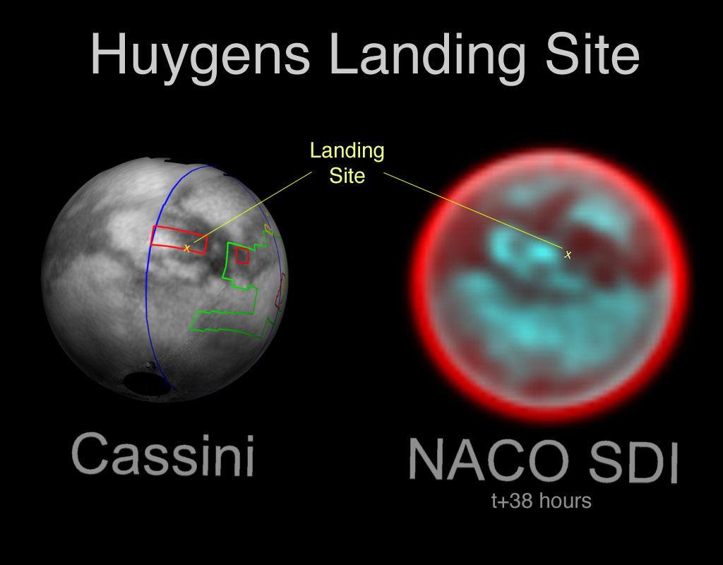
This image provides a comparison between the Huygens landing site on Titan as viewed by the Cassini Imaging Science Subsystem (ISS) and the NACO/SDI instrument mounted on the 8-meter Yepun telescope of the VLT (Very Large Telescope) station, in Chile.
From the two images it is possible to see a high consistency between the two measurements. The Cassini image - taken in the near-infrared (938 nanometers)- shows the Huygens landing site map wrapped around Titan, rotated to the same position as the January 2005 NACO/SDI observations.
The colored lines outline the regions that were imaged by Cassini at different resolutions. The lower-resolution imaging sequences are outlined in blue. Other areas have been specifically targeted to build moderate and high-resolution mosaics of surface features. These include the site where the Huygens probe has touched down on Jan. 14, 2005 (marked with the yellow X), and located at a latitude of 10.3° south and a longitude of 192.32° west (or 167.7° east).
The landing site is located on the boundary between the bright region called Adiri and the dark one called Shangri-la.
The red color on the NACO/SDI image corresponds to an atmospheric filter at 1.625 micron, while the blue color corresponds to a filter for the surface at 1.600 and 1.575 micron.
Credits: NASA/JPL/Cassini-ISS/Space Science Institute and ESO/NACO-SDI/VLT
