3 min read
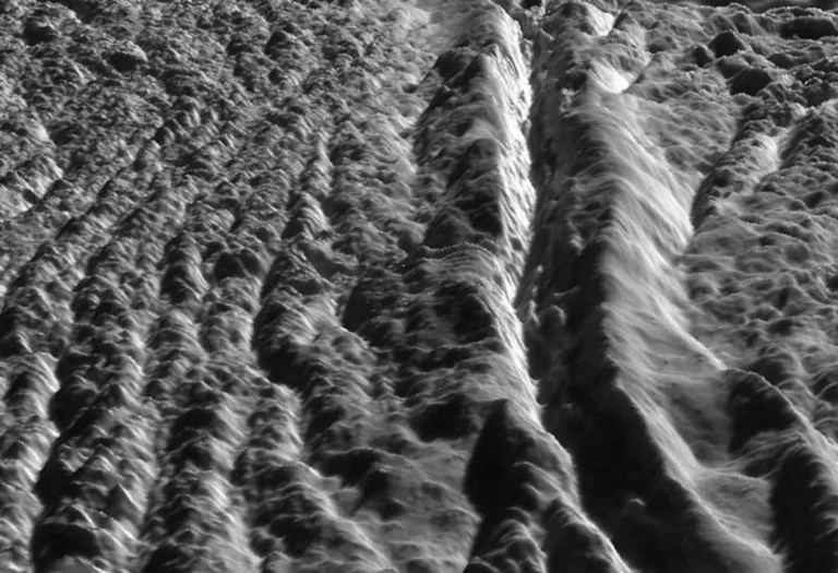
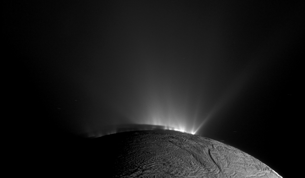
Cassini flew by Enceladus at an altitude of 100 kilometers and a speed of 7.7 km/sec. Closest approach occurred at 89 degrees S latitude and at 306T07:42 SCET. To convert this to Pacific Time, subtract 8 hours and add one-way light time from Saturn to Earth. It was a little after midnight on Nov. 2.
Information provided by the AACS team after the flyby will be used to understand how much torque the plume exerted on the spacecraft. E9, an Enceladus flyby to occur in orbit 130, will have a trajectory similar to E7. The data from AACS will be used to determine whether thrusters or wheels will be used for E9 attitude.
The Visual and Infrared Mapping Spectrometer (VIMS) performed compositional and thermal mapping of Enceladus’ surface and plumes. The data will be used to understand water ice grain size and ice crystal structure, and to map out the distribution of CO2 and organics on the surface, and to search for other compounds.
The Ultraviolet Imaging Spectrograph (UVIS) performed an experiment to measure the plume gas density by observing the plume in front of the disk of Saturn. In the past, UVIS has performed stellar occultations to measure plume gas density; in this experiment the disk of Saturn will be used in place of the star, and UVIS will investigate whether plume gas occults the Saturn signal.
With E7 being the first direct flyby through the Enceladus plume, and at a lower velocity than earlier inclined flybys, the Ion and Neutral Mass Spectrometer (INMS) was able to achieve very high signal-to-noise measurements of the gases in the plume, and looked for structure in the gases associated with the jets seen by ISS, UVIS and the Cosmic Dust Analyzer (CDA). Measurements should provide high enough signal-to-noise to allow INMS to discriminate between N2 and CO; distinguishing between these two species has been difficult in the past.
During the inbound leg RADAR took scatterometry measurements to determine cm-scale roughness and radiometry measurements to understand the energy balance. RADAR also targeted the instrument at Enceladus to execute a raster scan to obtain simultaneous scatterometry and radiometry data.
Magnetospheric and Plasma Science instruments took measurements to investigate interactions between Enceladus and its plume gases and the magnetospheric environment. The Magnetospheric Imaging Instrument in particular studied the field-aligned particles to explore connections to the Enceladus footprint in Saturn’s auroral region. The Cassini Plasma Spectrometer (CAPS) took measurements to map nanometer-sized charged particles and cold-water group ions. CDA explored the spatial alignment of the jets along Baghded and Alexandria sulci, and investigated the particle sizes of the ice grains in the jets.
Date
Nov. 2, 2009
Altitude
64 miles (103 km)
Speed
17,200 mph (7.7 km/sec)

