4 min read
Cassini is orbiting Saturn with a period of 12 days in a plane inclined 57.1 degrees from the planet's equatorial. The most recent spacecraft tracking and telemetry data were collected on Feb. 27 by a 34-meter Deep Space Network station at Canberra, Australia. Except for some science instrument issues described in previous reports, the spacecraft continues to be in an excellent state of health with all of its subsystems operating normally. Information on the present position of the Cassini spacecraft may be found on the "Present Position" page at: http://saturn.jpl.nasa.gov/mission/presentposition/.
This week Cassini made several remote-sensing observations called TEAs - Titan Exploration from Apoapsis, in which the Imaging Science Subsystem (ISS), the Composite Infrared Spectrometer (CIRS), and the Visual and Infrared Mapping Spectrometer (VIMS) make distant observations under illumination at low to moderate phase angles. Rain clouds are infrequent on Titan, so TEAs provide opportunities to document coincident atmospheric and surface changes.
Wednesday, Feb. 20 (DOY 051)
A TEA observation that was 23.5 hours long completed today while Titan was 1.2 million kilometers from Cassini. Shorter TEAs were conducted again on Thursday and Friday as well, with the distance to Titan increasing somewhat.
Cassini passed through apoapsis, having coasted "up" 1.53 million kilometers from Saturn and slowing to 12,424 kilometers per hour relative to the planet. This marked the beginning of Cassini's orbit #182.
Cassini's view of the enigmatic hexagonal wind pattern surrounding Saturn's north pole appeared as today's Astronomy Picture of the Day. The stunning image may be seen here: http://apod.nasa.gov/apod/ap130220.html
Thursday, Feb. 21 (DOY 052)
DSN stations on three continents conducted two-way communications with Cassini on thirteen occasions this week. During five of these, they also participated in operations readiness tests, preparing for the Feb. 25 Radio Science atmosphere occultation experiment.
Solving this mystery of the periodically varying behavior of Saturn's magnetic field is one of the highest priorities in the Cassini Solstice Mission.
Friday, Feb. 22 (DOY 053)
The Navigation team used ISS to take five images of Enceladus against background stars for optical navigation purposes. The Navigation team also delivered updated trajectory data in preparation for the Radio Science experiment coming up on Monday.
Saturday, Feb. 23 (DOY 054)
VIMS and the Ultraviolet Imaging Spectrograph (UVIS) pointed at the southern polar regions of Saturn, currently under the darkness of Saturnian winter, to study the planet's aurorae. Typical of most observations, the other optical remote sensing instruments, CIRS and ISS, took data while riding along.
Sunday, Feb. 24 (DOY 055)
Orbit Trim Maneuver (OTM) 341, the post Titan T-89 encounter trajectory cleanup maneuver, was performed today using the main engine. The 8.4-second burn provided a delta-V of about 1.4 meters per second.
VIMS made a movie of Saturn's south polar region. The Magnetometer then executed a calibration by rolling the spacecraft about its Z axis while Cassini was carrying out communications via the DSN.
Monday, Feb. 25 (DOY 056)
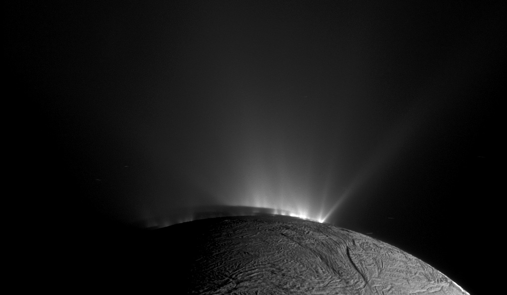
VIMS observed the Sun in order to perform a calibration of its solar port. ISS then turned the spacecraft and imaged Enceladus's south-polar plume while the 500-kilometer wide icy moon appeared as a slim crescent.
Next, the Radio Science team (RSS) executed a coherent-mode egress atmospheric occultation experiment. Behind Saturn, executing a block of commands whose timing was updated on Friday, Cassini turned to point its high-gain antenna to the location on the planet's limb where refraction would cause Earth to appear. There it found an X-band radio signal transmitted an hour and eighteen minutes earlier from the 70-meter DSN station in California. With its deep-space transponder locked to the DSN's reference frequency, the spacecraft transmitted phase-coherent S, X, and Ka-band signals as it emerged from behind the atmosphere and ionosphere. A total of four DSN stations in California and Australia captured the signals for RSS to record and later tease out vertical profiles of density, pressure, and temperature in the neutral atmosphere, and of electron density in the ionosphere.
Turning back to Saturn, VIMS made a regional map centered at 35 degrees south latitude, then watched the red star Gamma Eridani as it went into occultation behind the planet's limb. CIRS then targeted the storm region at 37 degrees north latitude for a mid-infrared observation.
An image featured today shows a gravity-induced "propeller" nicknamed Bleriot in the A ring: /resources/15744
Tuesday Feb. 26 (DOY 057)
Cassini's orbit period is only twelve days now; the spacecraft sped through periapsis today going 39,241 kilometers per hour relative to Saturn, at about 425,000 kilometers above the cloud tops.
CIRS made a measurement of the helium abundance at the RSS occultation egress point on Saturn's limb and then carried out a regional mapping of the northern polar area to measure temperatures. VIMS followed this activity by taking mosaics of the same region.

